
“], “filter”: { “nextExceptions”: “img, blockquote, div”, “nextContainsExceptions”: “img, blockquote, a.btn, a.o-button”} }”>
Heading out the door? Read this article on the new Outside+ app available now on iOS devices for members!
>”,”name”:”in-content-cta”,”type”:”link”}}”>Download the app.
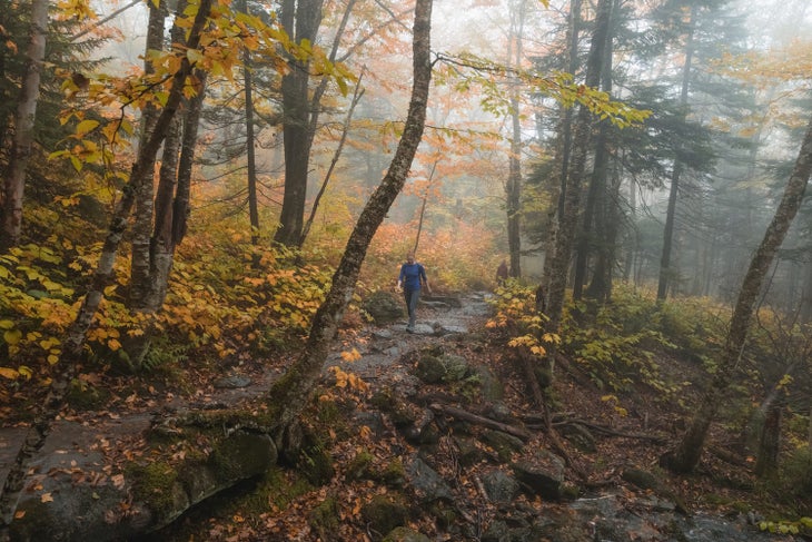
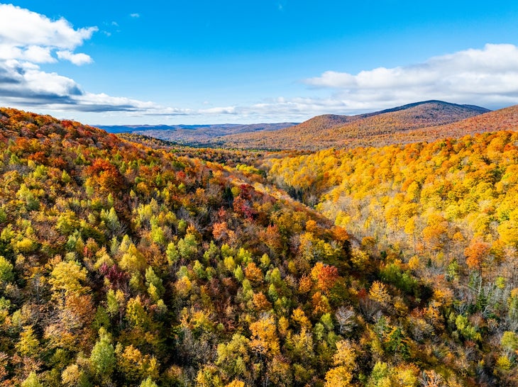
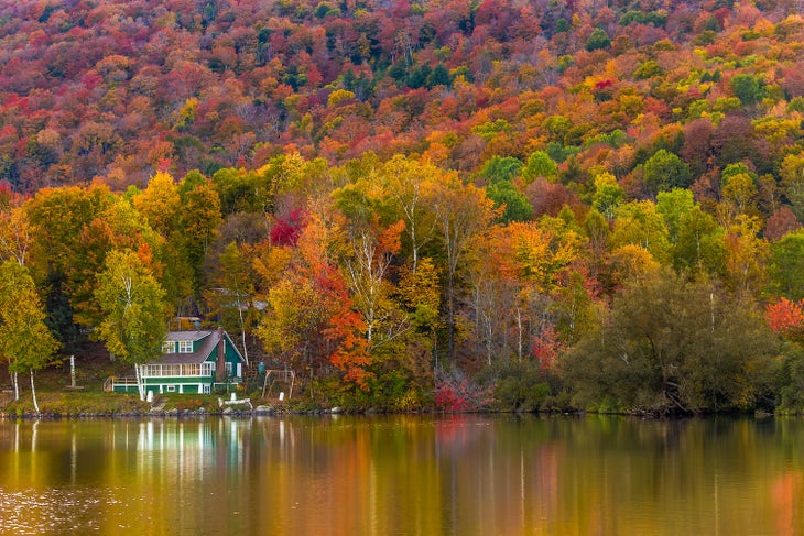
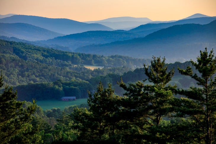
Vermont is a hiker’s paradise, with miles of scenic trails winding through dense forests and rolling hills and across rugged ridgelines. Crisscrossed by long-distance routes like the Long Trail and Appalachian Trail, Vermont’s best hikes offer everything from easy woodland walks to challenging climbs. Trails vary in length and difficulty, making it easy to find something that fits your pace and experience.
With four distinct seasons, Vermont’s landscapes shift from wildflowers and greenery to fiery foliage and winter quiet. Whether you’re after a quick afternoon hike or a multi-week backcountry adventure, Vermont delivers well-maintained trails, peaceful surroundings, and the kind of natural scenery that makes you want to keep exploring.
Here are 12 of the best trails in the Green Mountain State, offering a perfect overview of the beauty and variety of hiking found in Vermont.
The Long Trail
Trail Facts
- Distance: 272 miles
- Difficulty: Very Challenging
- Trailhead: Multiple throughout the state
- Permits/Fees: No (for individual hikers; organized groups might need one)
The Long Trail runs the length of Vermont, following the ridgeline of the Green Mountains from the Massachusetts border to Canada. With construction starting in 1910, it’s the oldest long-distance hiking trail in the U.S. It offers everything you’d expect from a classic New England backcountry route—steep climbs, slick roots, rocky scrambles, and serious mud. You’ll also find quiet ponds, sweeping ridgelines, and iconic peaks like Stratton, Killington, Camel’s Hump, and Mansfield, which tops out at 4,393 feet making it the highest point in the state. Popular day hikes like Little Rock Pond, Burnt Rock Mountain, the Appalachian Gap to Lincoln Peak stretch, and Camel’s Hump also offer easier access to the trail’s signature views and terrain. You can make it your own adventure with dozens of shelters, side trails, and swimming holes. For planning help, check out the Green Mountain Club’s trail guides and resources.
Monroe Trail/Alpine Trail Loop, Camel’s Hump, Duxbury
Trail Facts
- Distance: 6.2 miles out and back
- Elevation Gain: 2,583 feet
- Difficulty: Challenging
- Trailhead: Camel’s Hump Road Parking Lot
- Permits/Fees: No
At 4,083 feet, Camel’s Hump is Vermont’s third-highest peak and one of its most recognizable, thanks to its distinct double-humped silhouette. On a clear day, the summit delivers 360-degree views of the Green Mountains, Adirondacks, and White Mountains.
One of the most popular trails to the summit is the Monroe Trail, a 3.1-mile ascent through a birch and spruce forest. You can take the Monroe Trail straight up or add on the Alpine Trail for a scenic and slightly more challenging route. The steep .5-mile Alpine Trail leads to the wing of a WWII bomber that crashed in 1944. From the end of the Alpine Trail, turn left onto the Long Trail for the final push to the summit. The climb opens to sweeping views but includes steep, exposed rock. To descend, continue north on the Long Trail to Hut Clearing, then turn right to rejoin the Monroe Trail for a steady return to the trailhead.
Maple Ridge/Sunset Ridge Loop, Mt. Mansfield, Underhill
Trail Facts
- Distance: 7.3 miles
- Elevation Gain: 2,848 feet
- Difficulty: Challenging
- Trailhead: Underhill State Park
- Permits/Fees: Yes, Vermont State Parks have day-use fees
At 4,393 feet, Mt. Mansfield stands as Vermont’s tallest peak. The Maple Ridge/Sunset Ridge loop delivers sweeping views, rugged terrain, and one of the best summit experiences in the state. This loop follows the Maple Ridge Trail, a steep, rocky ascent that climbs quickly out of the trees at Mansfield’s forehead, the broad, gently rounded summit area just below the true summit known as “The Chin.” The open ridgeline provides panoramic views of the Champlain Valley and Adirondacks. You’ll join the Long Trail for a final scramble across the state’s largest alpine tundra zone to The Chin. Descend via the more gradual Sunset Ridge Trail, where open ledges and long sightlines stretch toward Lake Champlain and Camel’s Hump. Take the short spur to Cantilever Rock, a dramatic slab suspended from the cliffs.
House Rock Trail, Mt. Philo, Charlotte
Trail Facts
- Distance: 2.3 miles
- Elevation Gain: 896 feet
- Difficulty: Easy
- Trailhead: Mount Philo State Park
- Permits/Fees: Yes, Vermont State Parks have day-use fees
The 968-foot Mt. Philo is a quick and rewarding hike with wide-open summit views across Lake Champlain to the Adirondacks. The House Rock Trail climbs gently through hardwood forest to the peak, which sits within the 237-acre Mount Philo State Park, Vermont’s oldest state park. At the top, picnic tables, open lawns, and a scenic overlook make it a perfect spot to take a break and enjoy the views, especially in the fall, when foliage lights up the lake and hillsides. There’s also a seasonal auto road to the summit, making this peak one of the most accessible in the state.
Waterbury Trail, Mt. Hunger, Waterbury
Trail Facts
- Distance: 4.4 miles out and back
- Elevation Gain: 2,286 feet
- Difficulty: Challenging
- Trailhead: Sweet Farms Road, Waterbury Center
- Permits/Fees: No
The Waterbury Trail up Mt. Hunger is a steep and sometimes rugged 2.2-mile climb that earns every bit of its summit view. This is one of the more challenging hikes on the list, with little flat terrain and a final stretch of scrambling over open rock, which can be tricky when wet. Take a break at a small waterfall on the way up before pushing on to the bald summit, where you’ll find panoramic views of Camel’s Hump, Mt. Mansfield, Killington, and even Mt. Washington on a clear day. The fall foliage from the summit rivals anything you’ll see on Vermont’s taller peaks. If you’re up for a tough, beautiful climb, Mt. Hunger is well worth the effort.
Stowe Pinnacle Trail, Stowe Pinnacle, Stowe
Trail Facts
- Distance: 3.16 miles
- Elevation Gain: 1,618 feet
- Difficulty: Moderate
- Trailhead: Upper Hollow Road in Stowe
- Permits/Fees: No
This isn’t a quiet backcountry trek, but it’s one of the best viewpoints in the Stowe area. The Stowe Pinnacle Trail packs a lot of scenery in each step. After crossing open meadows, the trail climbs steadily through forest to a rocky summit with sweeping views of Mt. Mansfield, the Green Mountains, and the Stowe Valley. It’s one of the most popular hikes in the area, especially during the fall foliage season. The trail is well-maintained but can be steep and slick in spots. If you want to shave off a bit of distance, start from Pinnacle Meadows Trail, which cuts about a mile from the round-trip and still connects to the same summit.
Sterling Pond Trail, Smugglers Notch, Stowe
Trail Facts
- Distance: 2.4 miles out and back
- Elevation Gain: 930 feet
- Difficulty: Moderate
- Trailhead: Smugglers’ Notch across from the Visitor Center
- Permits/Fees: No, not for hiking. A permit is required to fish at the lake.
This short, steep 1.2-mile hike to Vermont’s highest trout pond is one of the best bang-for-your-buck trails in the state. Unlike Camel’s Hump or Mt. Mansfield, the Sterling Pond Trail isn’t a long ridgeline trek, but still delivers high alpine beauty. Starting at the top of Smugglers Notch, one of Vermont’s most scenic byways, the trail climbs through rocky forest to a peaceful glacial pond ringed by evergreens. Continue left around the shoreline to reach views over the Smuggs ski slopes and out to Mt. Mansfield. Especially stunning in fall, this hike pairs perfectly with the colorful, winding drive through Smugglers Notch. Like most Vermont trails, this one is rooty and rocky with a few steep steps.
West Trail, Snake Mountain, Addison
Trail Facts
- Distance: 4 miles out and back
- Elevation Gain: 975 feet
- Difficulty: Easy
- Trailhead: Mountain Road in Addison
- Permits/Fees: No
Tucked between farmland and forest in Addison County, Snake Mountain’s West Trail is a 2-mile hike that climbs steadily to one of the most underrated views in Vermont. The trail is a wide, old carriage road that winds through hardwood forest before ending at a rocky clearing with a stunning, unobstructed view of Lake Champlain, the Adirondacks, and the valley below. It’s a relatively easy hike with a few short, steep sections. At the summit, you’ll find the remnants of a 19th-century hotel that once stood at the top. Less crowded than trails around Stowe, Camel’s Hump, or Mt. Philo, Snake Mountain is a quieter option with a big visual payoff.
Fire Tower Trail/Ridge Trail Loop, Mt. Elmore, Elmore
Trail Facts
- Distance: 4-mile loop
- Elevation Gain: 1,450 feet
- Difficulty: Moderate
- Trailhead: Elmore State Park
- Permits/Fees: Yes, Vermont State Parks have day-use fees
Located in Elmore State Park, this 4-mile loop hike combines classic Green Mountain views with unique features such as Balancing Rock and a climbable fire tower. The loop connects the Fire Tower Trail with the Ridge Trail on its way to Mt. Elmore’s 2,608-foot summit. From the top, you’ll catch sweeping views west to the Green Mountains and east to New Hampshire’s Presidential Range, with Lake Elmore sparkling below. The trail is moderately challenging and offers just enough scrambling to keep things interesting.
Long Trail, Mt. Abraham, Lincoln
Trail Facts
- Distance: 4.83 miles
- Elevation Gain: 1,916 feet
- Difficulty: Challenging
- Trailhead: Lincoln Gap, Addison
- Permits/Fees: No
Known locally as Mt. Abe, this out-and-back from Lincoln Gap takes you to one of Vermont’s five 4,000-footers. The trail climbs through mixed forest before reaching an alpine tundra zone and a rocky summit at 4,017 feet, with far-reaching views of the Champlain Valley and the Adirondacks to the west, the Whites to the east, and Green Mountain peaks all around. It’s a challenging hike, but well worth it for the panoramic views and unique feel above treeline. Keep an eye out for the remains of a 1973 plane crash just off the trail. Bonus: The Long Trail crosses the summit, making it a favorite stretch for backpackers.
North Trail, Mt. Pisgah, Brownington
Trail Facts
- Distance: 4.82 miles
- Elevation Gain: 2,106 feet
- Difficulty: Moderate
- Trailhead: Rte. 5A in Brownington [3 miles north of the South Trail Trailhead on 5A]
- Permits/Fees: No
Overlooking Lake Willoughby in Vermont’s Northeast Kingdom, the Mt. Pisgah North Trail offers a quieter, steadier climb than the more trafficked southern route. This out-and-back leads to three distinct overlooks with dramatic views of the lake and the surrounding mountains. The cliffs here are sheer and impressive, and the trail is lined with hardwoods. The North Trail is a perfect choice for a peaceful hike with photo-worthy payoffs.
Blue Summit Trail, Equinox Mountain, Sunderland
Trail Facts
- Distance: 6.2 miles out and back
- Elevation Gain: 2,840 feet
- Difficulty: Challenging
- Trailhead: End of West Union Street, Manchester
- Permits/Fees: No
The highest peak in the Taconic Range, Equinox Mountain, rises to 3,848 feet. This 6.2-mile out-and-back via the Blue Summit Trail or Burr & Burton Trail is a challenging climb with nearly 2,900 feet of gain. A visitor center with bathrooms sits at the summit—also accessible by toll road—and just below is Lookout Rock, a short spur trail with views over Manchester village. From the top, you’ll get long views of the Green Mountains, Taconic Range, Valley of Vermont, and Adirondacks on a clear day. It’s steep and steady, and ideal for a full-day leg-burner with classic Vermont views.
Long Trail, Bromley Mountain, Peru
Trail Facts
- Distance: 5.71 miles
- Elevation Gain: 1,447 feet
- Difficulty: Moderate
- Trailhead: The trailhead is at the Appalachian/Long Trail crossing on Route 11/30, Peru
- Permits/Fees: No
This hike starts on the Long Trail in Peru, Vermont, and climbs gradually through the woods to the 3,260-foot summit of Bromley Mountain. The trail is moderate with a mix of forest and open ski trails near the top. On a clear day, expect views of the Green Mountains, Green Mountain National Forest, and distant ridgelines. The fire tower adds even more perspective. For a unique finish, some hikers shuttle a car to the base of Bromley Mountain Resort and descend via the alpine slide (ticket required). It’s also a great hike for sunrise or sunset.