
“], “filter”: { “nextExceptions”: “img, blockquote, div”, “nextContainsExceptions”: “img, blockquote, a.btn, a.o-button”} }”>
Heading out the door? Read this article on the new Outside+ app available now on iOS devices for members!
>”,”name”:”in-content-cta”,”type”:”link”}}”>Download the app.
In 2015, New Mexico’s state legislature established a commission to develop a 500-mile cross-state trail along a portion of the Rio Grande. The resulting route, which has yet to be completed, would travel through three national wildlife refuges, six national monuments, six state parks, and a national heritage area. The idea was that the trail’s establishment would foster environmental protections and economic prosperity in the region. Even unfinished, it’s already beginning to attract adventurers. I’m one of them.
A long-time lover of New Mexico’s high desert peaks and steep canyon walls. I learned about the trail this winter and quickly decided to hike an existing section of it. After a 2022 road trip took me through the I-25 corridor, I found myself unable to stop thinking about New Mexico’s array of mountains, volcanic rock, and towering canyons. It didn’t take long for me to realize that the state didn’t receive nearly enough recognition for its outdoor places; the Colorado Rockies and Sierra Nevada unjustly overshadow it. Two hikes along the Rio Grande Trail only confirmed my theory.
Backpacking the Rio Grande Trail
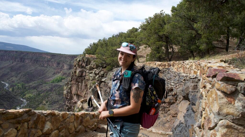
A five-hour drive took me from my home in Denver to the city of Taos, where I slept at the Taos Historic Inn for a night before beginning my adventure just northwest of the city. The next morning, I drove 30 minutes to the Cebolla Mesa Campground, a first-come-first-serve National Forest campground on the rim of the Rio Grande. The road leading up to the campground had recently been graded, making it easy for a small SUV to navigate its sandy terrain. When I reached the campground, it was mostly empty on a Wednesday afternoon, save a party or two.
After parking my car at the trailhead, I heaved my pack over my shoulder before descending into the canyon on the Wild Onion Trail, a 2.4-mile route that overlooks the river. The majority of the trail currently follows existing routes, forcing adventures to use a map or GPS app. Eventually, the Wild Onion Trail connects with La Junta Trail, and the River Trail over the course of about 5 miles. Then the Rio Grande Trail climbs back out of the canyon on the Big Arsenic Trail.
I rolled my eyes when a trail friend told me that this area felt like the Grand Canyon due to its steep walls and eroded boulders. But it only took me a few minutes of hiking to understand his meaning. The rumbling of the river was constant and self-assured. And the canyon walls stretched hundreds of feet up from the river. It was the kind of view that made me feel small and inconsequential – and I like that feeling.
Everywhere I looked, the remnants of spring’s showers blossomed in hues of green. The local sage bushes stretched their plump arms toward the sky, the scent of juniper whispering through the canyon. The hiking was easy, the trails sandy and packed-down.
As I continued north, a few small patches of scree and boulders added challenge to the trek. The sky turned purple, promising afternoon showers despite the clear forecast.
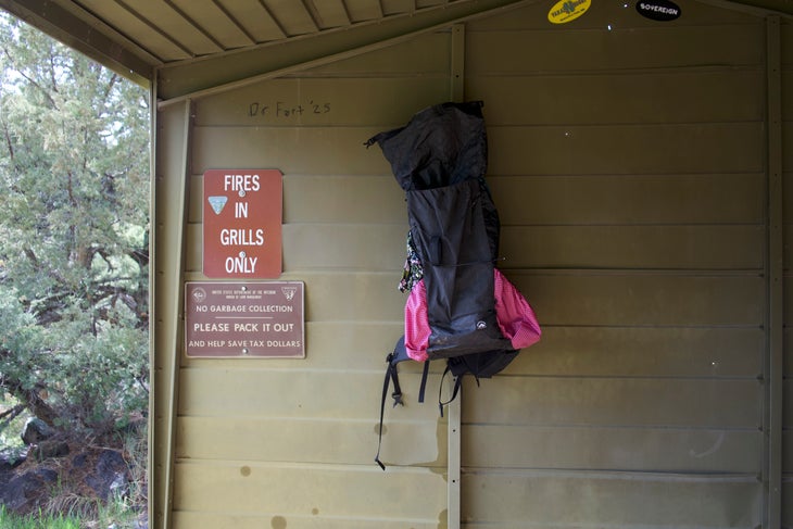
While the storms grew closer, I raced down a side trail littered with green picnic shelters – each with its own fire ring and picnic table. Marble-sized ice chunks began falling from the sky just as I slipped under the safety of a shelter.
I pitched my tent when the pitter patter of the rain slowed to a halt. When the sun peeked out again, I continued exploring the area by climbing out of the canyon, following the rim before reaching the corridor just west of Guadalupe Mountain before heading back to my camp spot for the night. My daily mileage tallied at about 11 after the bonus exploration took me west of Guadalupe Mountain before I returned to my campsite for the night.
As darkness fell, I wandered the area surrounding my tent and located a series of petroglyphs. Deer-like drawings covered one rock face, while a figure that looked almost like an alien to me covered another portion of the rock. The carvings reminded me that, even though the area felt remote and untouched, humans had been frequenting it for thousands of years.
A Dayhike on the Rio Grande Trail
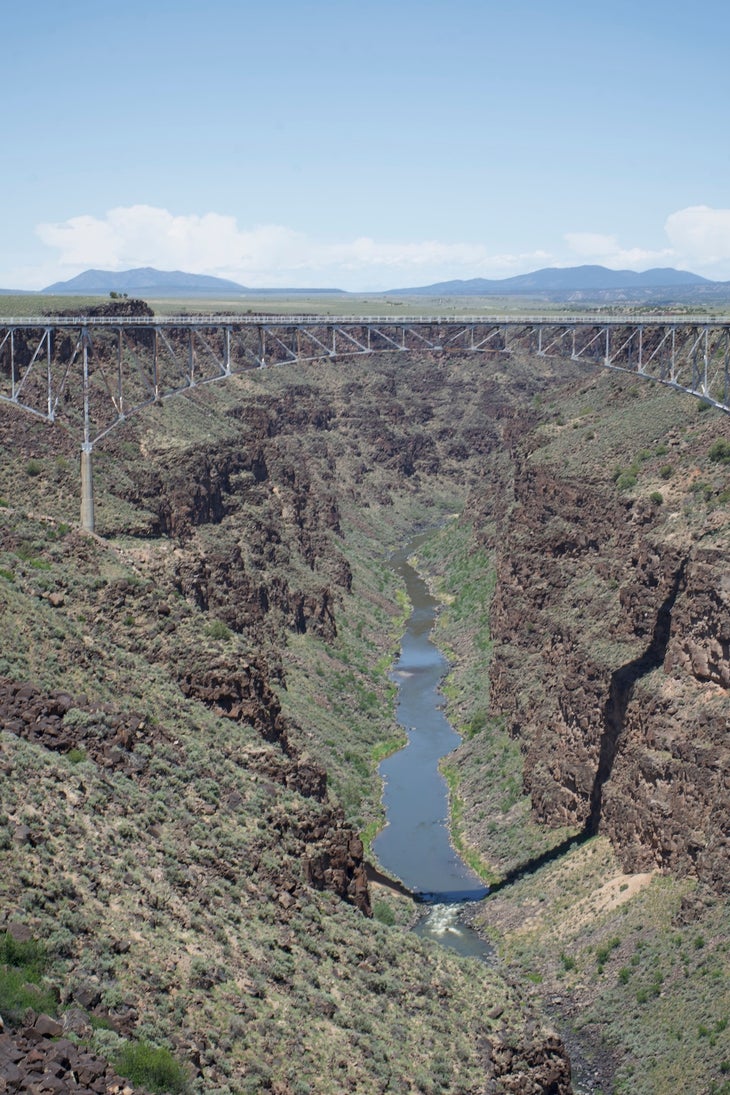
Before making my way back home, I stopped to hike the Rio Grande Trail again. This time, my goal was a 10-mile stretch south of the Rio Grande Gorge Bridge. Like the northern section of my Cebolla Mesa hike, the Gorge Bridge area followed the Rio Grande from the rim, giving me sweeping views of the canyon as I hiked. This portion of trail seemed finely graded and flat in elevation, and it was also clearly a favorite location for local mountain bikers. The beauty of this stretch of trail was being able to peer into the canyon and witness the 600-foot drop from the Gorge Bridge to the canyon floor.
Trail Building and Designation Efforts
As of right now, about 100 miles of the Rio Grande Trail are complete, leaving another 400 miles to be developed. During a recent interview, Carl Colonius, the Program Manager for New Mexico’s Outdoor Recreation Division, explained that a quarter of those remaining miles have been identified as an acceptable route. They just need to move through the formal designation process to be completed. The good news is that since New Mexico founded its Outdoor Recreation Division in 2019, efforts to formalize those trail sections are moving quickly (or at least quickly when it comes to trail development).
One of my biggest concerns about a thru-hike of the Rio Grande Trail revolves around its water access. A few days before hitting the trail, I opened up a trail map on my phone to look for river crossings and bodies of water in the region. Much of the segment I hoped to hike followed the rim of the Grande, instead of the shoreline, which made me wonder how or if I’d be able to access a refill spot. My dayhike confirmed my suspicion that water access could prove difficult, although there were a handful of areas along the trail where a very determined hiker could descend to the river for water. My overnight trip along the Cebolla Mesa Segment, on the other hand, was full of water access until I climbed out of the canyon.
On a phone call, Colonius told me that builders are prioritizing the development of water access points and intentionally routing the trail through towns to add support for long-distance backpackers as well as encourage hikers to support local businesses. While the Rio Grande Trail still has years to go before it’s a well-established thru-hike, it’s a beautiful project in the making, and I’d be excited to tackle the whole thing.