
“], “filter”: { “nextExceptions”: “img, blockquote, div”, “nextContainsExceptions”: “img, blockquote, a.btn, a.o-button”} }”>
Heading out the door? Read this article on the new Outside+ app available now on iOS devices for members!
>”,”name”:”in-content-cta”,”type”:”link”}}”>Download the app.
We haven’t even met yet, and Jon King’s already got a read on me. It’s an early April morning in Idyllwild, California, and we’re meeting to hike his “backyard trail,” the South Ridge Trail up to 8,836-foot-tall Tahquitz Peak. Driving up to our meeting spot, I gulp at the steep, rocky approach to the South Ridge trailhead, which we’ll take by car. This gauntlet would certainly chew up and spit out my Prius. Looking my car up and down, he pops a sly grin and tells me that he doesn’t want to stereotype, but when he heard I was driving to Idyllwild from San Diego, he had a hunch that I’d be arriving in a Prius. Sure, you could call it a lucky guess, but King has had plenty of practice predicting hiker behavior. It’s the thing he does best.
King, 56, is the founder of the San Jacinto Trail Report, a digital log that tracks trail conditions for the mountain range of the same name. It draws up to 150,000 page views per year from up to 40,000 individuals and is a crucial resource for both local hikers and those just passing through. This mountain range, home to peaks over 10,000 feet, is the first that northbound Pacific Crest Trail thru-hikers encounter about 150 miles into the trek. Many hikers falsely assume the San Jacintos share the mild climate of the surrounding desert. In reality, feet of snow can accumulate on precarious slopes in this area, usually lasting through April and May. According to the trail report, for the past seven years, the highest elevations have averaged 9 feet of snowfall per year. This area is often a setting for high-stakes rescues. Just this year, search and rescue teams pulled off a three-day-long rescue after a pair of hikers fell 800 feet off Tahquitz Peak. In 2023, due to record snowfall, local SAR groups urged PCT hikers to skip the 60-mile section altogether.
After volunteering with search and rescue for just over a decade, King, a retired endangered species wildlife biologist, wanted to try a different approach to mountain safety. He thought a shift toward proactivity—supplying information about trail conditions before people even start their hikes—could help prevent rescues. This approach is known as preventative search and rescue, or PSAR. The 2013 to 2015 hiking seasons really exemplified the need for resources like the trail report, King says. The region had been experiencing low levels of precipitation, and visitors assumed that Southern California as a whole was a dry desert. Meanwhile, the San Jacinto mountains had received the highest snow levels in years.
“We had lots of problems because people just weren’t prepared for it,” King says. “There was nothing [online or in print] that suggested that would be the case.” So in 2015, he started writing a trail report, hoping to prevent safety issues that stemmed from a lack of information.
Initially, King printed his report on paper and distributed it at local businesses in Idyllwild. Now, it exists as an online log that organizations such as the Riverside County Sheriff’s Department, San Bernardino National Forest, Mt. San Jacinto State Park, and Pacific Crest Trail Association recommend to local hikers. The average post contains a weather report, an update on trail conditions for multiple trails on the mountain, and often pictures from King’s latest hike. There’s generally a new update every week, even more often if there’s a storm. However, because he’s on the trail daily, he usually makes minor tweaks or adds information to an existing report nearly every day.
Data backs everything in the report. King vets all information prior to publication; almost all of it comes from his own fieldwork, but the remainder is from a handful of trusted sources. He aims to write neutral, fact-driven reports that accommodate beginner and expert hikers alike, and he never posts an opinion on whether a reader should or shouldn’t hike. Instead, he describes conditions objectively and lets people decide for themselves.
For PCT thru-hikers, this mountain range is the first stretch where they’ll need snow safety equipment. Apache Peak and Fuller Ridge are two standout sections for thru-hikers. In 2020, PCT hiker Trevor Laher died on Apache Peak when he attempted to hike without the proper gear. Fresh snow covered the ice and gave the illusion of safety, and Laher slipped and fell down a 600-foot chute. Fuller Ridge is also tricky to pass. The angle of the slope has the tendency to accumulate icy snow, and because it’s on the north side of the mountain, snow melts slowly. Four years ago, King posted a video of himself hiking the icy, snow-packed trail carrying, but not using, spikes and an ice axe. Within hours, the trail report received a donation from a couple hiking the PCT.
“They said, ‘We’re from the middle of the country; [we don’t have] snow and ice experience. Thank you so much for posting the video. That gave us the information we needed to make the decision that we’ll skip that section,’” King says.
This is precisely the point of PSAR. “Sometimes people are a bit hyperbolic and say, ‘Oh, you probably saved my life,’” King says. “You never know, and that’s the thing with PSAR. Do I save one life a year, or do I save five or 10? I don’t know, and I frankly don’t care, in the sense that if I save one, then that’s all that matters.”
The report is scientific and precise, like it’s an extension of King’s biology career. He hiked and backpacked as a means of performing wildlife work, which sent him to about 25 countries, including Australia, Sub-Saharan African countries, many countries in Europe, every country in Central and South America, and more. He eventually found his way to California, where he has trained forest service and park rangers near Lassen National Park in bird monitoring techniques. Today, he employs the same observational approach on his local trails as he did in his career.
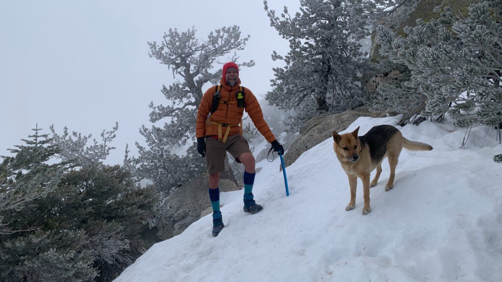
The trail report runs on 100 percent volunteer effort—it’s the product of more than 2,000 hours of work each year, and King does it mostly alone. Sometimes his wife, Anne, his Jindo-German Shepherd mix, Anabel, or some of his hiking pals will accompany him on the trails, but King alone updates the report and handles the logistics. Donations mostly go toward purchasing gear that King needs to hike in all conditions. To keep the report reliable and up to date, he goes out in whatever weather the mountain throws at him.
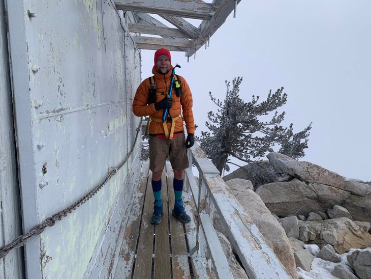
Each year, King logs between 4,000 and 5,000 miles and around a million feet of elevation gain and loss. This is the equivalent of at least two PCTs. He also holds the all-time record for most summits up San Jacinto Peak; as of July 8, 2025, he logged his 1,066th summit. (Until 2021, Sid Davis held the record of 643 ascents.) On our hike together, his fitness is overwhelmingly obvious. At 6’4”, he strides up the steeps with his arms crossed, never quite out of breath, at a pace that has me scurrying to keep up.
Up the South Ridge Trail, we’re pretty much alone the entire time—likely because the heavy cloud cover, temperatures just above freezing, and damp wind fend off the average southern California hiker. King, wearing shorts, is reveling in these conditions. Meanwhile, I’m fully covered yet chilled to the core, slapping feeling back into my fingers.
“In Southern California, we see the sun 350 days a year, so when you get a day like this, you’ve got to make the most of it,” he says. If there are conditions too poor for him to stay inside, he hasn’t found them yet: “I have lots of unofficial mottos for the trail report. One of them is, ‘the worse the weather, the more likely I am to be out there.’”
Many who know how much King hikes ask if he ever gets bored of the same trails, over and over, year after year. According to King, the trail is “never the same two days in a row.” That’s because he’s not just hiking. He’s also birding, maintaining sections of trail, studying and identifying what types of snow has fallen, and looking for signs of wildlife, like scat or pawprints.
On our hike, he often interrupts himself mid-anecdote to point out an endemic plant, like the Tahquitz ivesia, or point out a branch that he personally trimmed to maintain the trail. A lot of the trails in the area don’t get regular maintenance from agency crews, and King says he informally adopted the South Ridge Trail over a decade ago, along with a half-dozen other trails. As we’re hiking, he tosses fallen branches off-trail and cleans up the path without even breaking his stride.
“I normally carry a pair of loppers,” King says. “Every time I come down, I just put a little bit [of work in]. When you’re hiking the [South Ridge] trail 50 times a year, it all adds up. Sometimes I’ll do five minutes, sometimes I’ll do half an hour, depending on the weather or what else I’ve got going on.”
Of course, King’s work with the trail report has its challenges. He receives over 1,000 messages per year, and he tries to respond to each within 48 hours. During the early months of Covid, hikers swarmed his inbox as agency offices closed. People emailed him with questions about trails they planned to hike within a couple hours or with complaints about closures, as if King had anything to do with it.
“I’m absolutely happy to be unpaid to go hiking,” King says. “But to be unpaid, sitting in front of a computer answering emails, that’s probably the only aspect of the report that’s become—what’s the right word—a bit of a burden.”
Overall, the positives outweigh the negatives. The report is the product of King’s own interests: hiking and mountaineering, meteorology, wildlife observation, data collection, and ultimately helping others. He says another unofficial motto of the trail report is, “I can help some of the people some of the time, hopefully most of the people most of the time, but I can’t help all the people all the time.”
At the end of our hike, back at our cars, a Subaru slows down and stops in front of King. The couple recognized him as they drove past (a common occurrence around Idyllwild) and were buzzing at the chance to meet him and tell him that they voted for him to win an award that honors Idyllwild locals who exemplify volunteerism at its best.
King’s quick to deflect praise. I refer to him as a bit of a local celebrity after the Subaru drives off, but he points to Anabel, who joined us on the hike, and says she’s probably more famous than he is. To the best of King’s knowledge, she’s the only dog in this area to survive a bite from a neurotoxic snake. “The wilderness dog,” King says, visibly softening his usual stoic, matter-of-fact demeanor.
Back at our cars, we continue chatting for another 15 or 20 minutes. Although I’m eager to retreat to the Prius and crank the heat, King’s wit and charm keeps our conversation going. King’s in no rush to depart, anyway. On the mountain, he’s right where he needs to be.